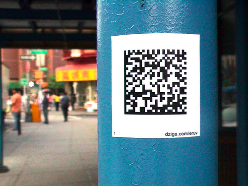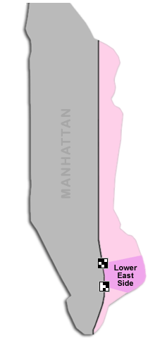
eRuv is a digital graffiti project installed along the route of the former Third Avenue elevated train line in lower Manhattan. The train line, dismantled in 1955, was more than just a means of transport; it was part of an important religious boundary – an eruv – for Orthodox Jews on the old Lower East Side. Using semacodes, the former boundary is reconstructed and mapped back onto the space of the city, allowing pedestrians with cameraphones to access location-specific historical content.
 The semacodes are concentrated along the boundaries of the old Lower East Side, the neighborhood where Hasidic Polish Jews lived among other immigrants. Each semacode links to an archival photo of the train line from that specific location.
An eruv (pronounced ay-roov) is a structure erected around orthodox Jewish communites throughout the world. It usually consists of a series of poles connected by a cord that circumscribe an urban neighborhood, often incorporating existing municipal infrastructure such as utility poles and electrical wires. They are erected with the permission of local authorities and in accordance with the lengthy and complex set of architectural laws set forth in the Talmud. The construction of eruvin (or eruvim, plural for eruv) stems from the observation of Shabbat, the weekly day of rest (Friday sundown to Saturday sundown) that includes a prohibition against carrying objects outside of one’s home, or private domain. According to most Rabbinic authorities, the shared public space within an eruv is considered the private domain of the community. In this way, observant Jews can carry their keys or prayer books on the Sabbath while acting in accordance with sacred principles.
Natural topographic boundaries such as rivers, cliffs and ravines can form one or more legitimate sides of an eruv. For this reason, it is possible from a number of Talmudic perspectives to consider the entire island of Manhattan an eruv. This has been debated over the centuries-long course of Jewish habitation in the city – rabbis differ over the extent to which the island would require physical intervention for it to qualify as an eruv.
In 1907, Rabbi Yehoshua Siegel, a renowned Talmudic authority who had immigrated to the Lower East Side from Poland, published Eruv V’Hotza’ah. He wrote: “With regard to the city of New York, where we are presently living, the issue has come before the trembling ones that it is possible to permit carrying on Shabbat throughout the East Side. The argument is that the water which surrounds it on three sides should be considered a complete wall because of its depth. The fourth wall is a door frame like none other: the elevated iron pathway which stretches the length of the city, from one end to the other, from the water of the southern tip, South Ferry, to the water at the northern tip, without any interruption to Harlem.” The eruv was soon refuted by other prominent rabbis and rejected en masse by Lithuanian Jews who also lived on the Lower East Side at the time.
- The Laser Eruv
- Eruv FAQ
- Jewish Spatial Practice
- Talmudic Places in a Postmodern World
- The Dead Sea Scrolls & The Origins of the Eruv
- Route Map
- Original Proposal
More About The Third Avenue Elevated Train
- LES stickers
- Psychogeography
- New York Songlines
Links to Related Ideas
What is semacode? A semacode is a visual code representing a unique URL, or web address. Semacodes can be printed on paper or adhesive stickers and put on walls, streets, or objects. In order to access the links, you need a semacode reader or compatible camera phone connected to the Internet.
Special thanks to Rabbi Yehuda Sarna of NYU for advice and Hebrew translation throughout the project. Also, thanks to Stan Wiechers, Technical Lead on the project.